Product Overview
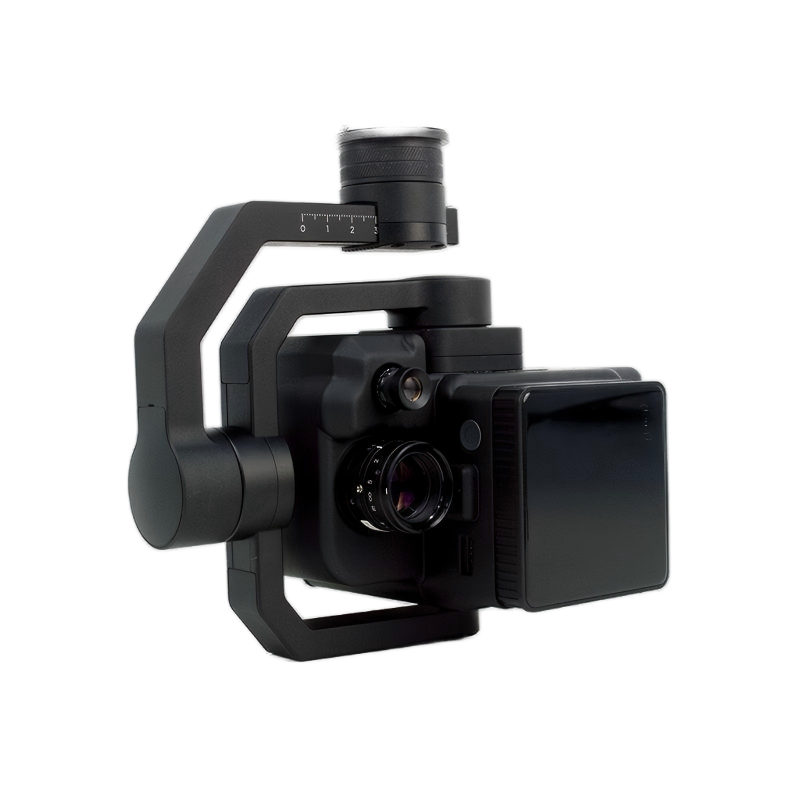
The Venuslab FS-50/30 is a next-generation, lightweight multispectral imaging module purpose-built for high-end UAV system integration. Within an incredibly compact form factor, this payload innovatively merges a high-resolution holographic grating with an ultra-clear 1/1.1-inch image sensor. It not only provides pristine 2K-level spatial images but also outputs 30 continuous, precise spectral channels in the 400-1000nm band with a 20nm step.
Thanks to its native X-Port interface, low power consumption, and excellent anti-vibration structure, the FS-50/30 effortlessly handles large-scale, high-frequency aerial mapping missions. Whether assessing field crop health in harsh outdoor environments or conducting water quality inversions in complex river/lake ecosystems, it provides system integrators and field researchers with reliable, lab-quality optical data.
Key Features
- 30 VNIR Spectral Bands: Continuous coverage from 400nm to 1000nm with a precise 20nm step.
- High Spectral Resolution: 3.5nm Full Width at Half Maximum (FWHM) for highly accurate material identification.
- 1/1.1" CMOS with Global Shutter: 1920 spatial pixels (2K) ensuring distortion-free aerial mapping at high speeds.
- Standard X-Port Compatibility: Ready for direct power and data integration with mainstream commercial UAVs (e.g., DJI Enterprise).
- Massive Onboard Storage: Integrated 512GB SSD guarantees uninterrupted, large-area data collection.
- Professional Data Format: Outputs 12-bit .SPE files, natively compatible with industry-standard analysis software like ENVI.
Typical Applications
Precision Agriculture & Forestry: Crop health (NDVI) and moisture monitoring, early warning of pests and diseases, forest vegetation coverage calculation, and rare tree species classification.Ecology & Water Environment Research: River/lake eutrophication assessment (chlorophyll/suspended matter inversion), black and odorous water body screening, and soil heavy metal/organic matter pollution analysis.Emergency Relief & Target Recognition: High-contrast recognition of camouflaged targets in complex terrains, geological disaster assessment, and rapid mineral resource exploration.